Southwestern Colorado faces a critical weather event this weekend as a moisture-rich system tracks across the state, bringing the threat of historic flooding to Archuleta County. Denver7 reported that the San Juan River in Pagosa Springs is expected to reach record-breaking levels by Sunday evening, creating a significant hazard for residents in low-lying areas.
The San Juan River has a current record high of 17.8 feet. Meteorologists now forecast the river will crest at 19.38 feet by Sunday night. This surge is part of a broader, powerful system that will dump an estimated 2 to 4 inches of rain on the region, raising concerns about flash flooding beyond the riverbanks themselves.
Officials Warn Residents About Flood Risks
Local officials are urging residents to avoid areas near swollen rivers and low-lying ground until the system moves through.
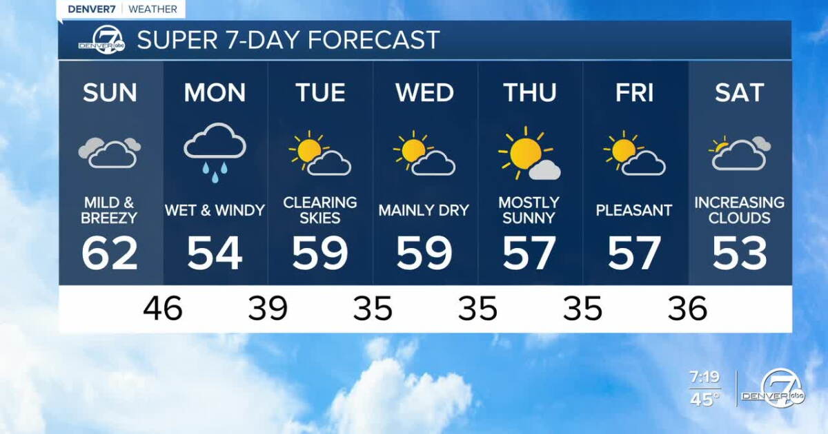
While the southwestern corner of the state braces for a deluge, the Front Range will experience a more tempered version of the storm. Denver is expected to see only scattered rain showers tonight, with the bulk of the moisture staying well west of the metro area.
Snow Creates Hazardous Conditions for Mountain Commuters
By Monday morning, the weather profile will shift significantly for those in the higher elevations. Snow levels are projected to drop to between 8,000 and 8,500 feet, which will likely turn mountain passes into hazardous zones for morning commuters. Drivers should prepare for slick conditions, particularly as the storm intensifies in the northern mountains.

| Region | Primary Weather Threat | Timing |
|---|---|---|
| San Juan River/Pagosa Springs | Historic River Flooding | Sunday Evening – Monday Morning |
| Mountain Passes | Slick Roads / 5-10″ Snow | Monday Morning |
| Front Range | Scattered Rain / Strong Winds | Monday |
Total snowfall in the mountains is expected to reach between 5 and 10 inches, with the northern range receiving the highest accumulation. As the week progresses, the atmosphere will stabilize. Monday night will see the precipitation taper off as drier air moves into the region, potentially leaving a dusting of snow around the Palmer Divide. Tuesday is currently forecasted to be mostly dry, with temperatures returning to seasonal averages before a weaker system brings a secondary chance of light mountain snow on Wednesday.
For those tracking the storm’s progression, the Denver7 weather page provides real-time updates on radar and traffic impacts. The coming 48 hours will test the region’s emergency readiness as the San Juan River pushes toward its highest recorded stage in history.
Archuleta County Evacuation Update URGENT FLOOD WARNING: EVACUATE NOW!The updated forecast calls for flooding above historic levels. The San Juan River could crest as high as 19.71 feet around 11:00 p.m. tonight.If you are in an evacuation zone, you must leave now. This…