The Rare Thrill of Crossing State Lines on Foot
Most of us experience state boundaries as a blur of highway signage, a momentary glance at a map, or the sudden transition of road pavement quality. It is a functional, often invisible part of American travel. Yet, at a handful of points across the country, those borders become tangible, physical spaces where you can plant one foot in one state and the other in the next. According to World Atlas, there are specifically six bridges where pedestrians can walk across these invisible lines, turning a standard commute or a casual stroll into a distinct geographical event.
These crossings are not merely curiosities; they are infrastructure that has been repurposed to serve the modern demand for outdoor recreation. While some were built for the industrial age—designed to carry heavy rail traffic or automobiles—they now function as vital links for hikers and cyclists.
From Nebraska to Iowa: The Bob Kerrey Pedestrian Bridge
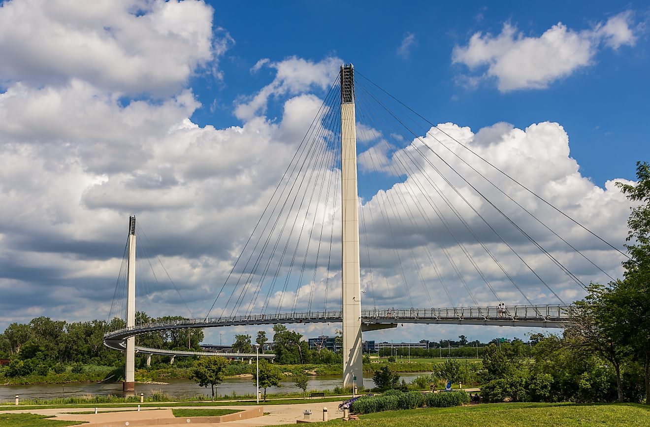
Known locally as “Bob the Bridge,” this cable-stayed structure in Omaha, Nebraska, and Council Bluffs, Iowa, holds the distinction of being the longest pedestrian bridge linking two states. Opened in 2008, it rises 60 feet above the Missouri River. The bridge is more than just a path; it is a monument to the region’s history. On the Nebraska side, walkers find themselves near the Lewis and Clark National Historic Trail Headquarters, a location that commemorates the expedition’s original trek along these same waters. It is a rare spot where a 3,000-foot paved walk offers a literal bridge between 19th-century exploration and 21st-century urban connectivity.
Historic Meridian Bridge Links Two States
Further north, the Historic Meridian Bridge offers a different kind of experience. Connecting Yankton, South Dakota, to Cedar County, Nebraska, this double-deck vertical-lift bridge stands as a testament to early 20th-century engineering. Construction began in 1921, and it officially opened to traffic in 1924. While it once served vehicles, its conversion in 2011 to a pedestrian and bicycle path allowed for a unique dual-level experience. Walkers can cross on the upper level and return on the lower, effectively walking over the same river twice while standing in two states simultaneously. It provides a convenient, low-impact way for residents to access the City of Yankton Forest Tract hiking trails.
Memphis and West Memphis: The Big River Crossing
The Mississippi River has long served as a massive, often impenetrable barrier between Tennessee and Arkansas. The Harahan Iron Bridge, which opened to rail traffic in 1916, was transformed into the Big River Crossing in 2016. At one mile long, it is the longest public pedestrian and cyclist bridge across the Mississippi. The experience is sensory; the Union Pacific Railroad still operates on the upper level, meaning pedestrians often walk alongside the rumble and horns of freight trains. It is a stark reminder of the economic engine that the river remains, even as the bridge serves a modern recreational purpose by linking park networks on both banks.

Engineering Legacies in Cincinnati and Kentucky
The Ohio River is home to two of the most iconic pedestrian-accessible bridges in the country. The Purple People Bridge, which connects Cincinnati, Ohio, and Newport, Kentucky, is a vibrant, steel-structured link that has become a hub for festivals and firework viewings. Originally opened in 1872 as a railway bridge, it was repurposed for pedestrians in 2003. Its neighbor, the John A. Roebling Suspension Bridge, offers a more historic resonance. Designed by the same engineer who would later create the Brooklyn Bridge, the Roebling was the world’s longest bridge at its completion in 1866. Today, it remains a National Historic Landmark, where the “singing” sound of vehicle tires on the steel-grate deck accompanies pedestrians as they move between the Great American Ballpark and Smale Riverfront Park.
The Desert Arch: The Mike O’Callaghan-Pat Tillman Memorial Bridge
Not every border crossing is a low-altitude river walk. The Mike O’Callaghan-Pat Tillman Memorial Bridge, which spans the Colorado River between Clark County, Nevada, and Mohave County, Arizona, offers a dramatic contrast. Sitting 890 feet above the water, it is the longest single-span concrete arch bridge in the Western Hemisphere. Unlike the other crossings, this path is accessed only from the Nevada side. It is a stark, high-exposure walk that highlights the engineering required to bypass the Hoover Dam. It is not merely a path; it is a vantage point for one of the most rugged landscapes in the American West.
While these bridges provide a thrill for the casual walker, they also highlight a tension in urban planning: the balance between industrial utility and public access. Not all of these bridges allow for a full transit from one side to the other, and some remain tethered to the freight rail systems that built the American interior. The question of whether these spaces can continue to support both heavy commerce and increasing pedestrian demand remains open. As cities continue to reclaim their waterfronts, the future of these connections will likely depend on maintaining that delicate, steel-and-concrete equilibrium.


