A deadly pattern at Florin and 24th
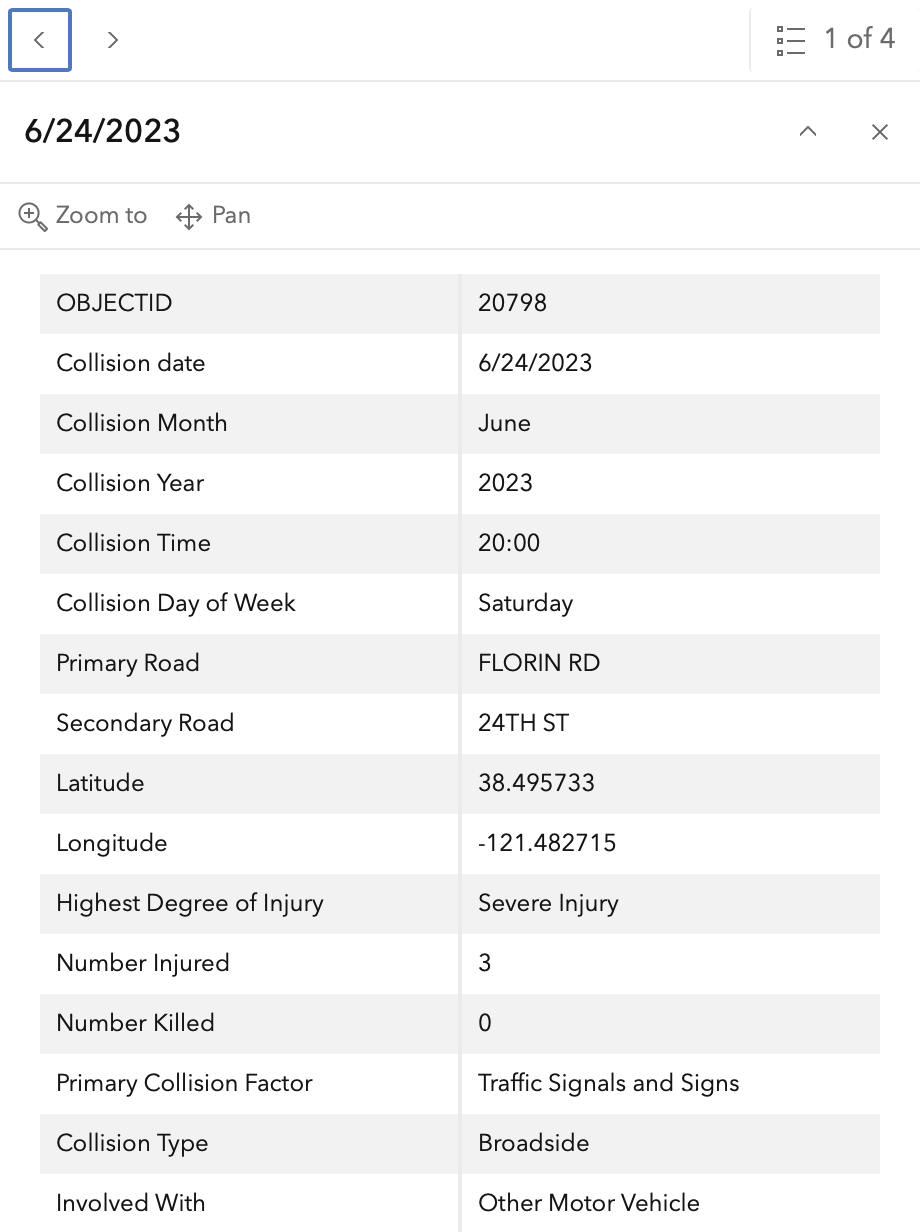
One person died and three others were severely injured at the intersection of Florin Road and 24th Street between 2015 and 2024, according to data from the Sacramento Vision Zero Action Plan Update.
The intersection is designated as a high-priority site within the city’s safety framework, identified as “Intersection 8” in the official report. The fatalities and severe injuries involved both motor vehicle occupants and bicyclists, including a fatal crash that occurred on February 2, 2020.
While the Vision Zero data focuses on these most critical “killed or severe injury” (KSI) incidents, the intersection sees a higher volume of lesser accidents. These include “other visible injury” and “complaint of pain” crashes, particularly along 24th Street.
Florin Road and 24th Street feature wide lanes and concrete medians
The physical layout of the intersection creates a complex environment for different types of travelers. Florin Road is a wide thoroughfare, featuring five lanes eastbound and six lanes westbound. 24th Street follows a similar pattern, with six lanes southbound and five lanes northbound.
Pedestrians face physical barriers at this junction. All four legs of the intersection are equipped with concrete medians, and the eastbound approach of Florin Road includes a barrier fence specifically designed to prevent pedestrians from crossing the median.
While the city has recently installed upgraded marked crosswalks in the Sacramento pattern at all legs, bicycle infrastructure remains inconsistent. East of the intersection, Florin Road features a new buffered bike lane on the north side and a Class 2 bike lane on the south side. However, no bicycle facilities exist on the other roadways.
Speed limits also vary by direction and street. 24th Street has a posted limit of 35 mph, while Florin Road to the east is posted at 40 mph. Because the city no longer maintains a public database or map of speed limits, the exact limit for Florin Road to the west remains unconfirmed by official city records.
| Roadway Segment | Posted Speed Limit | Bicycle Facilities |
|---|---|---|
| Florin Road (East) | 40 mph | Buffered & Class 2 lanes |
| 24th Street | 35 mph | None |
| Florin Road (West) | Unknown | None |
Wide lanes and inaccurate crash reporting complicate safety
On 24th Street northbound, there is a wide area that may have been intended for a bike lane, but it lacks official signage and functions as an extremely wide travel lane of approximately 36 feet.
The reporting also touches on the complexities of how these incidents are recorded. There is often a discrepancy in crash locations within police reports, and entries labeled as “pedestrian violation” may not always reflect the actual responsibility of the parties involved, particularly when a pedestrian is deceased and unable to provide a counter-account.