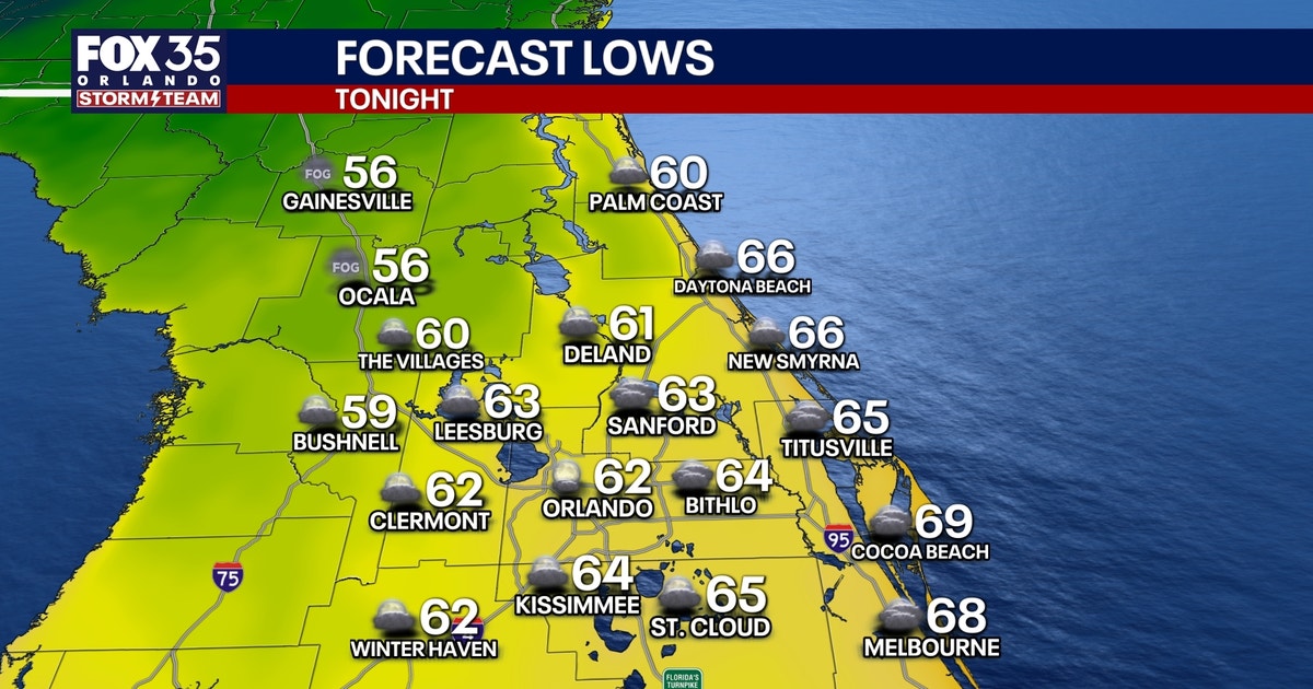
Bright sunshine and a crisp northern breeze swept across Central Florida on Sunday.
The weekend cold front brought a welcome break from last week’s heavy humidity, setting up comfortable outdoor conditions for the start of the week, according to FOX 35 meteorologist T.J. Springer.
Afternoon highs are expected to reach near 80 degrees under nearly clear skies. Overnight lows will drop into the mid-to-upper 50s in inland counties like Marion, Lake, and Sumter, while the metro area can expect early Monday morning temperatures in the low 60s.
Despite the pleasant weekend weather, local authorities are keeping a close watch on regional waterways. River Flood Warnings remain active along the St. Johns River, including gauges at Cocoa, Geneva, Sanford, DeLand, and Astor.
Even though no new rain is falling, runoff from last week’s historic soaking continues to drain slowly through the basin. This sustained drainage means water levels will stay in minor to moderate and locally major flood stages through the start of the workweek before finally receding.
Conditions will begin to shift by midweek as winds turn toward the east and southeast. This wind shift will pull low-level tropical moisture back into the state just as an upper-level trough and approaching cold front sweep across the Gulf.
Rain chances will climb to 30 to 40 percent from Wednesday into Thursday. The shift will bring scattered showers and a few embedded thunderstorms to Central Florida.
A reinforcing push of Canadian air is projected to follow the front by Friday. The system will bring an even cooler weekend with highs struggling to escape the 70s and overnight lows dipping back into the 40s and 50s.
Meanwhile, the Atlantic basin remains quiet as hostile late-season wind shear dominates the region. The National Hurricane Center anticipates zero tropical development across the Gulf, Caribbean, or Atlantic over the next seven days, presenting no tropical threats to Florida or the U.S. mainland.