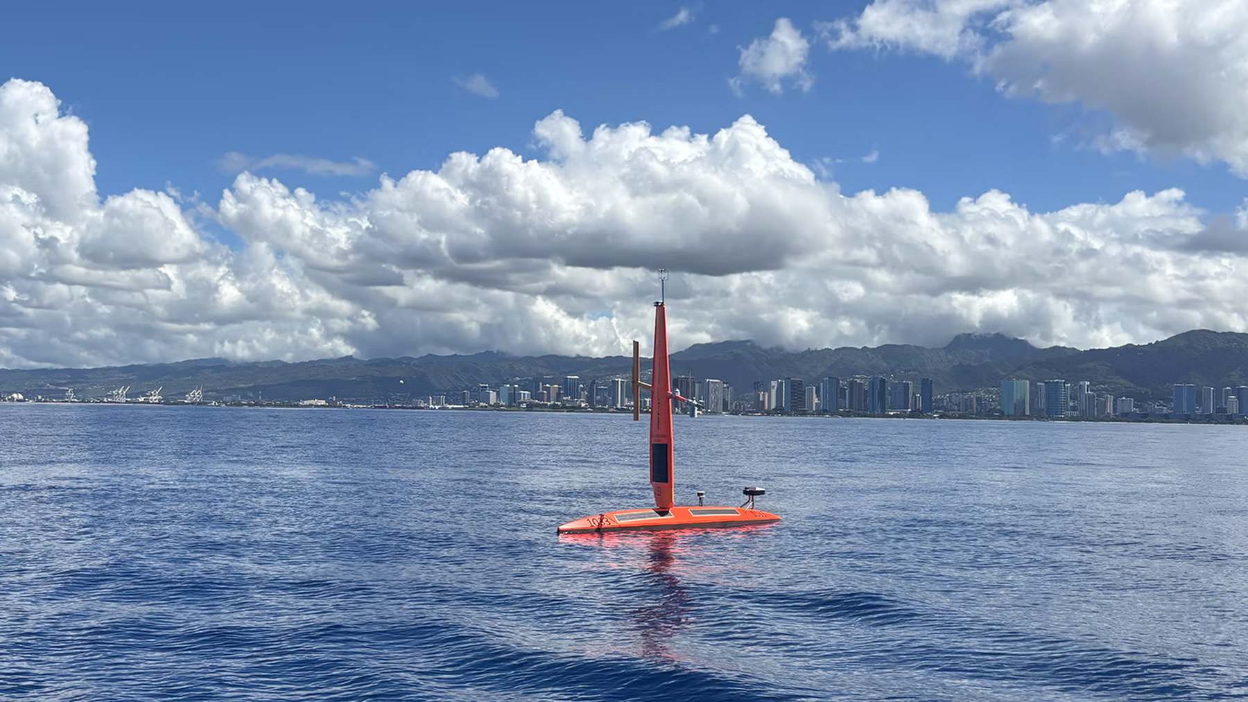
Four uncrewed, 23-foot drone sailboats have deployed from Honolulu to the equatorial Pacific to gather high-resolution data on an El Niño event that could be the strongest since records began in 1950. These Saildrone Explorers, operated by a California-based company in partnership with NOAA’s Pacific Marine Environmental Laboratory (PMEL), are targeting the “Niño 3.4 region”—the specific box that NOAA watches to decide how strong an El Niño is, as reported by Autonocion.
This mission isn’t just about academic curiosity; it’s about precision. While satellites and moored buoys provide a broad overview, they leave gaps.
The Pacific is running hot
In an October 26 update from the Climate Prediction Center, the weekly reading in the Niño 3.4 box was 4.5°F above normal. Further east, off the coast of South America, the water was running 7.9°F warm. NOAA estimates an 83% chance that this will become a historic event between October and December.
To understand why this matters, you have to look at the plumbing of the Pacific. Normally, trade winds push warm surface water west toward Indonesia. When those winds weaken, that heat slides back east, shifting the jet stream and scrambling weather patterns thousands of miles away. We aren’t just talking about a slightly warmer ocean; we’re talking about a massive redistribution of energy that dictates whether a farmer in California sees a deluge or a drought.
The current readings are far beyond the 0.9°F threshold NOAA uses to officially designate an El Niño. While a single hot week doesn’t equal a three-month average, the trend is difficult to ignore. The July-through-September average already sat at 3.1°F above normal.

Why buoys aren’t enough
Critics might ask why we need drone boats when the ocean is already littered with the Tropical Pacific Observing System—a network of satellites and moored buoys. The answer is mobility. A buoy is a stationary sentinel; it stays where it is chained to the seafloor. But the “edges” of warm water move. To get accurate data, scientists need to follow those edges in real-time.
Meghan Cronin, the PMEL research oceanographer leading the project, noted that satellites read the ocean from orbit, making direct sensor contact essential for verification. The Saildrones provide that “ground truth.”
“You can walk this fast!”
Cronin wrote that in the mission’s logbook, referring to the boats’ average speed of 1.7 knots (roughly 2 mph). It’s a slow crawl, but it’s a cost-effective one. Traditionally, this kind of data required a full research vessel and a crew of scientists living at sea for months. Now, solar-powered drones do the work at a fraction of the cost.
The hardware and the carbon question
Each Explorer is equipped with a 15-foot rigid wing and a keel extending 6.6 feet deep. They aren’t just measuring temperature; they are tracking salinity, humidity, air pressure, and water currents down to 250 feet.
Under normal conditions, the eastern Pacific acts as a vent, releasing CO2 into the atmosphere as cold, carbon-rich water wells up from the deep. El Niño shuts that process down.
Sailing through a symptom
The journey hasn’t been a straight line. The first pair of drones, SD1033 and SD1077, departed Honolulu on August 21. The timeline for the second pair, SD1088 and SD1090, is slightly contested—the agency’s announcement suggests the week before August 31, while the logbook marks August 31. Regardless, by September, all four were battling the very conditions they were sent to study.
By September 4, the drones had to detour 180 nautical miles to avoid Hurricane Lowell, a Category 4 storm. They endured 36-knot winds and 14.8-foot waves. While Saildrone builds specialized hulls for Atlantic hurricanes, these equatorial boats are designed for endurance and speed (by drone standards), not for riding out a Category 4 eye. Interestingly, Hurricanes Karina and Marie were active in the eastern Pacific simultaneously—a rarity that is itself a classic side effect of El Niño.
The drones are effectively sailing through the symptoms of the fever they are trying to measure.
Fleet collects data before returning to Hawaii
The mission is currently in its peak data-collection phase. Based on the 1,100 nautical mile trek from Honolulu, the fleet has likely been operating in the equatorial region since late September. If the four-month window holds, the first boats will begin their return journey to Hawaii around the end of the year.
| Region | Location | Oct 26 Temp Departure |
|---|---|---|
| Niño 4 | Western Pacific | 0.0°F |
| Niño 3.4 | Central Pacific (Target) | +4.5°F |
| Niño 3 | Eastern Pacific | +6.5°F |
| Niño 1+2 | Off South America | +7.9°F |
The next major milestone for those tracking the weather will be November 12, when the Climate Prediction Center is scheduled to publish its next official El Niño discussion. As Michael McPhaden, a former senior scientist at PMEL, put it, a “monumental El Niño is knocking at the door.”