Phoenix Approves Long-Term Framework for Rio Salado Corridor
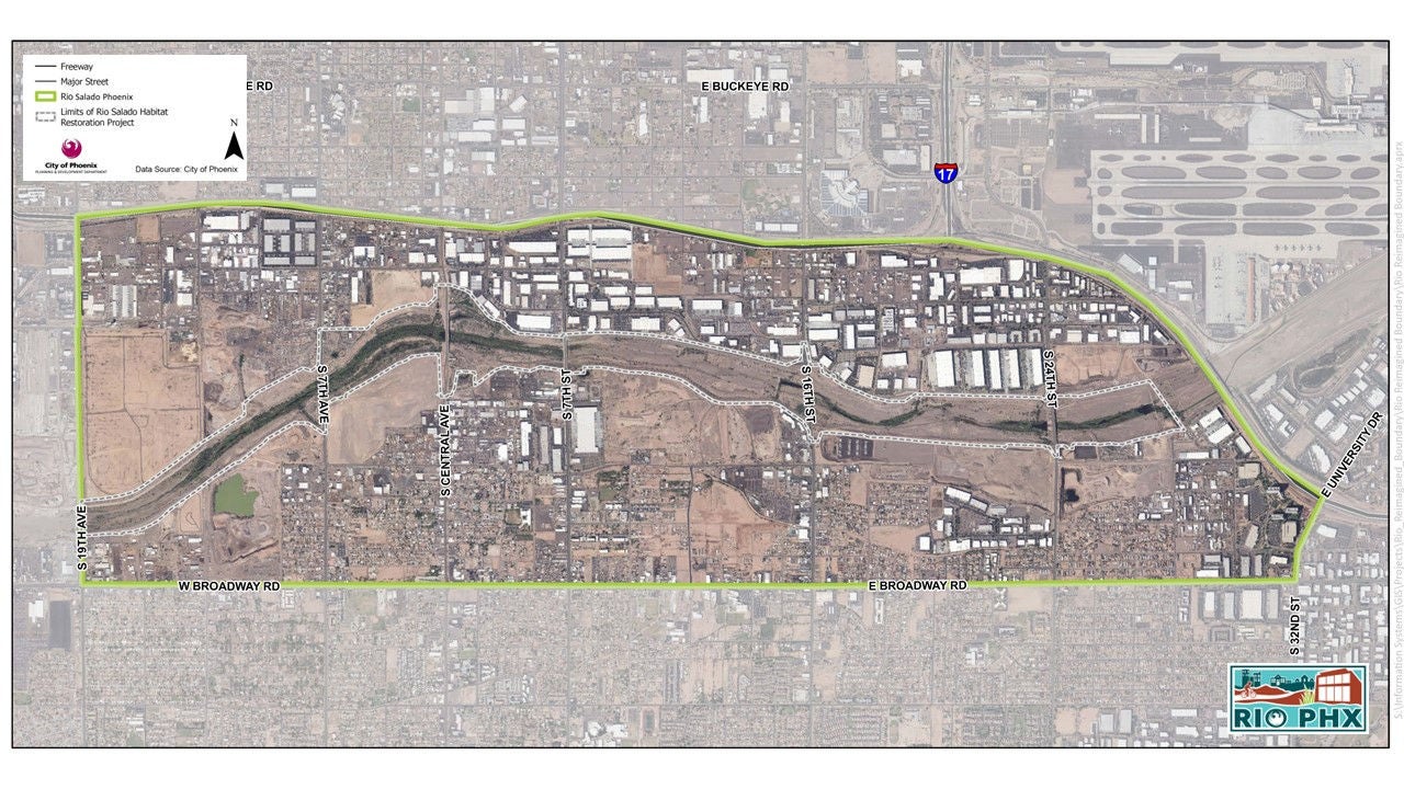
The Phoenix City Council has officially approved the Rio Salado District Policy Plan, a decision that sets the stage for a massive, multi-decade transformation of the riparian corridor winding through the heart of the city. This move marks the first major milestone for RIO PHX, a city-led initiative aimed at re-establishing the Salt and Gila river corridors as central community assets. According to the city’s official RIO PHX planning portal, the framework covers approximately 20 miles of land, stretching through a complex mix of industrial zones, natural spaces, and established neighborhoods just south of Downtown.
For a city that has spent decades grappling with the environmental and social scars of its own industrial past, this vote represents more than just a zoning update. Mayor Kate Gallego described the plan as a regional commitment to honor the river that gave the community life, framing the policy as a tool to ensure that future development provides recreational and economic opportunities for generations to come.
Balancing Growth with Neighborhood Preservation
The policy plan itself does not authorize specific construction projects or alter existing zoning laws immediately. Instead, it creates a long-term roadmap intended to guide how the city evaluates future investment. The core challenge lies in the corridor’s history. As District 7 Councilwoman Anna Hernandez noted during the proceedings, the area has long suffered from infrastructure neglect and deliberate planning choices that marginalized Black and Latino families.
For generations, the City of Phoenix made choices that harmed the communities along the Rio Salado. It drew lines that kept Black and Latino families out of the north side, withheld basic infrastructure, and routed Interstate 17 through the neighborhoods that were left. Residents here know what it looks like when growth happens to a community instead of with it. With this plan, the City has a chance to do it differently.
Vice Mayor Kesha Hodge Washington emphasized that the extensive public engagement process specifically highlighted a local demand for more residential opportunities, signaling that the city aims to integrate new growth rather than displace the people who have lived in the corridor for decades.
Rio Corridor Could Transform into Mixed-Use Hubs
The Rio Salado has long been viewed as a divide, but the RIO PHX initiative aims to turn it into a connector. The economic stakes are high; the corridor contains a significant amount of industrial property that could, under the right conditions, be repurposed into vibrant mixed-use hubs. The policy plan mandates a focus on protecting natural resources, but the actual implementation will depend on how the city balances the competing interests of developers and community activists.
District 4 Councilwoman Laura Pastor pointed out that the plan is deeply personal for many families who have roots in the area. By aligning the City’s General Plan Land Use Map with this new district framework, the council has created a legal anchor for future decisions. Yet, as Councilwoman Hernandez warned, the success of this project will be measured by how the city handles the transition from policy to practice. The real test begins now, as the city moves to coordinate with property owners and community partners to turn these broad, long-term goals into concrete infrastructure and housing projects.
For now, the framework stands as a symbolic and legislative shift in how Phoenix views its riverfront.