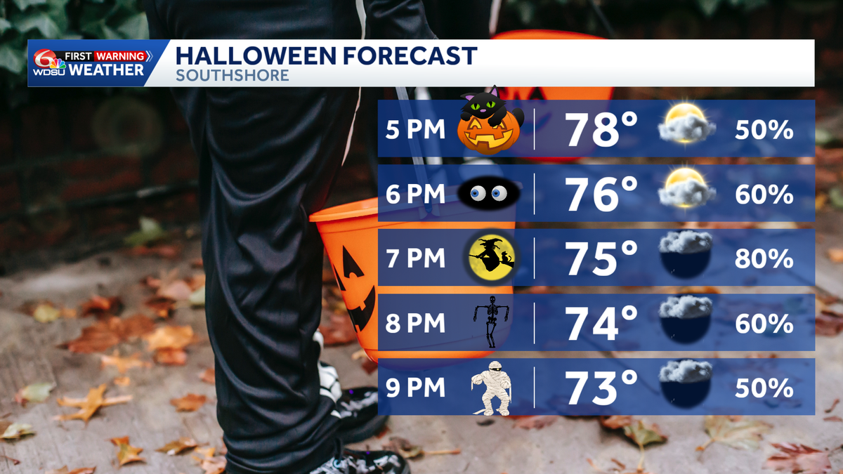
Showers and a few thunderstorms could arrive around midday Saturday in southeast Louisiana and southern Mississippi, potentially disrupting trick-or-treating plans for families celebrating the holiday, wdsu.com reported.
Midday Timing Threatens Holiday Costumes
As of Thursday morning, forecasts indicate that rain might begin by midday or during the afternoon hours across the region. The exact timing of the wet weather will vary by location, leaving families wondering if costumes will need to accommodate raincoats.
Evening Festivities Face Persistent Rain Risks
Showers remain possible throughout Saturday evening. Because of the lingering precipitation risk, families should prepare a backup plan for outdoor festivities. Meteorologists are still working out precisely where the rain will develop and which neighborhoods might catch dry breaks during the evening candy hunt.
Warm Temperatures Clash With Wet Weekend Forecast
Despite the incoming moisture, the afternoon will feel warm, with temperatures hovering around 80 degrees in New Orleans. Rain chances will persist into Saturday night, alongside a few showers and storms potentially carrying over into Sunday.
Pacific Moisture Feeds Approaching Weather Disturbance
This return of wet weather stems from a weather disturbance approaching from the west, which is pulling more moisture into the area after an extended dry stretch. Some of that atmospheric moisture is tied to Pacific system Vance, which is currently moving through Mexico and Texas. However, Vance itself is not forecast to make landfall in Louisiana.
Lightning Prompts Safety Warnings for Outdoor Crowds
Current meteorological setups do not favor severe weather for Saturday. Even so, lightning and passing downpours could still interrupt outdoor activities. Anyone heading outside who hears thunder should move indoors and wait for the storm to pass.
For now, residents are advised to keep their plans intact while monitoring updated forecasts from WDSU First Warning Weather before heading out.