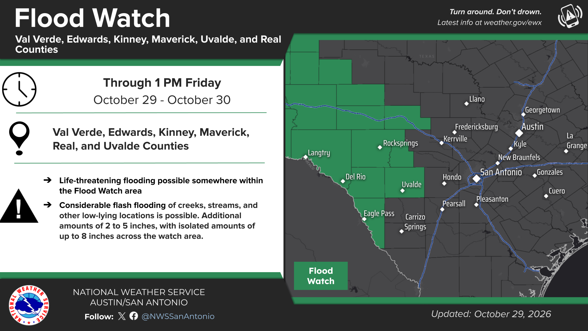
On 30 October 2026 at 00:13 UTC in the United States, where Washington, D.C. serves as the capital, a flood watch remains in effect across Southwest Texas and the Texas Hill Country, with heavy rainfall expected to persist through Friday afternoon, October 30, 2026, according to the San Antonio Express-News. Readers can follow live updates on the United States incident tracker.
Counties and Cities Under Immediate Threat
The alert directly encompasses the cities of Uvalde, Leakey, Eagle Pass, Brackettville, Del Rio, and Rocksprings.
According to the San Antonio Express-News, the hazardous weather conditions are slated to stay active until at least 1 p.m. Friday afternoon. Off-and-on heavy rainfall will continue throughout Thursday evening before a second, more intense wave pushes into Southwest Texas during the early morning hours on Friday, particularly between 5 a.m. and 10 a.m.
530 PM: Locally heavy rain rates up to 1 inch per hour continue to soak into the already wet soils along the Rio Grande from Del Rio to Eagle Pass and El Indio. Lighter rates less than 1/4 inch per hour are expected over most areas. Heaviest rates are expected after midnight. pic.twitter.com/Ia4erOqitD
Heavy Rainfall Threatens Widespread Flooding
Forecasters anticipate widespread rainfall totals between 2 and 5 inches across the watch area through Friday afternoon. In isolated spots, severe downpours could dump up to 8 inches of rain.
There is a potential for life threatening flooding somewhere in the watch area. Excessive runoff may result in flooding of rivers, creeks, streams, and other low-lying and flood-prone locations. — National Weather Service
Because of these severe projections, official guidance warns that travel is not recommended across the watch area. Global Incident Tracker monitoring data classified the moderate-severity flood event after detecting the regional weather signals, noting that flash floods in urban and rural environments can rise within minutes as sealed surfaces and swollen creeks fail to absorb excessive runoff. First recorded from news reports (Google News) on 30 Oct 2026 at 00:20 UTC with event time 30 Oct 2026, 00:13 UTC, the incident occurred near approximate coordinates 29.424°, -98.494° (San Antonio).
Broader Regional Impact Across Texas
While the most acute danger concentrates in the western counties, the weather system spans a wide footprint. Large parts of West Texas, including Midland, Odessa, Big Spring, and Lubbock, remain under a flood watch into Friday afternoon.
Farther east along the Interstate 35 corridor, San Antonio and much of the Texas Hill Country escaped inclusion in the official flood watch, though unsettled weather persists. Commuters and residents in these areas should still expect off-and-on rainfall overnight and into Friday. Most eastern locations will see additional rainfall amounts under an inch, though isolated higher totals remain possible.