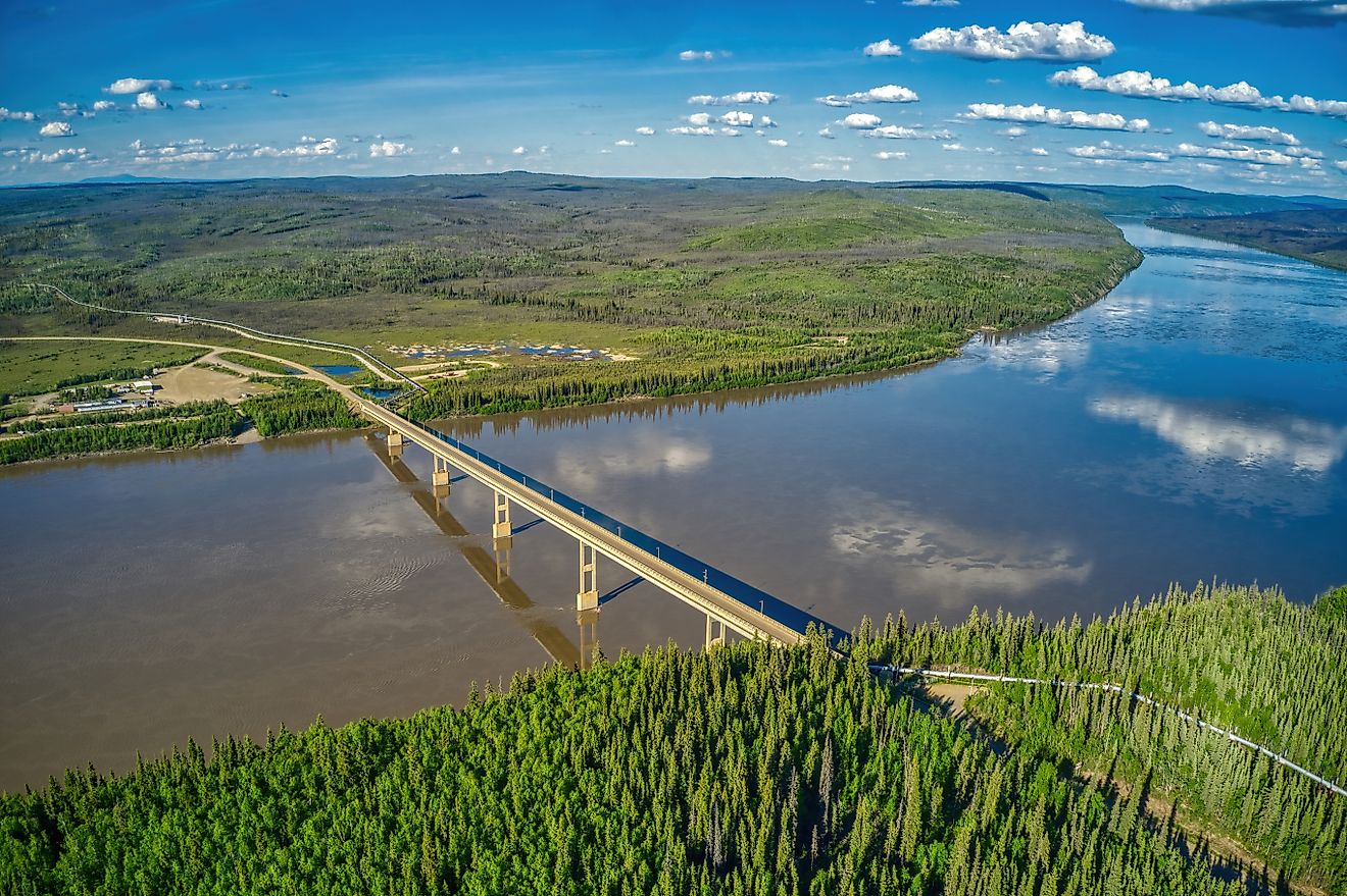
The Mississippi and Yukon rivers are similar in length—roughly 2,350 and 1,980 miles respectively—but differ fundamentally in their utility. While the Mississippi is a highly engineered industrial corridor for global freight, the Yukon remains a wild, seasonal waterway where human activity is dictated by the freeze-thaw cycle of the North.
When you look at a map, these two giants seem like peers. But the reality on the ground is a study in contrast between human dominance and natural endurance. One has been bent to the will of the U.S. Army Corps of Engineers to fuel a global economy; the other still tells the people living along its banks when they can move, when they can ship on it, and when they cannot move on it at all.
The Engineered Highway vs. The Seasonal Road
The Mississippi is less of a natural river and more of a precision tool. At its source in Lake Itasca, Minnesota, it’s a mere stream you can cross with stepping stones. Left to its own devices, much of the upper river would only run three to four feet deep. To fix this, the U.S. Army Corps of Engineers has spent decades maintaining a 9-foot channel up to Minneapolis and utilizing 29 locks and dams north of St. Louis to move towboats. Below Baton Rouge, the channel deepens to 45 feet, allowing ocean-going ships to reach New Orleans.
The economic stakes here are massive. A single barge can carry the load of 60 semi-trucks, and a single towboat can push 15 of those barges. This infrastructure allows towboats to carry Midwest corn south through a 9-foot channel and 29 locks and dams. For the American agricultural sector, the Mississippi isn’t just a river; it’s a conveyor belt.
The Yukon operates on a completely different clock. In Alaska, there is only one bridge across the entire river: the E.L. Patton Yukon River Bridge on the Dalton Highway, which serves the Trans-Alaska Pipeline. For everyone else, the river is the road, but only when the temperature allows.
In villages like Fort Yukon, survival depends on a narrow window. Heavy cargo arrives by barge from late May through mid-September. Once the river freezes, the barges stop, and the water transforms into an ice road connecting neighboring villages. In Dawson City, a summer ferry is replaced by an ice bridge every winter. This creates a precarious dependency on the “breakup”—the moment the ice thaws in spring.
A Tale of Two Volumes
The scale of these systems is vastly different. The Mississippi drains about 1.2 million square miles—roughly 40% of the continental U.S.—meaning rain in Montana or snow in Pennsylvania eventually meets in the Gulf of Mexico. The Yukon’s basin is smaller, at 330,000 square miles, but it is far more volatile.
| Metric | Mississippi River | Yukon River |
|---|---|---|
| Approximate Length | 2,350 miles | 1,980 miles |
| Drainage Basin | 1.2 million sq miles | 330,000 sq miles |
| Average Flow (at mouth) | 593,000 cu ft/sec | 236,000 cu ft/sec |
| Primary Use | Industrial Freight | Subsistence & Local Transport |
While the Yukon averages about 40% of the Mississippi’s flow, its seasonal swings are violent. Most of its volume arrives during the warm-season melt. In 1984, flow at Pilot Station dropped to 35,000 cubic feet per second; by 2005, it peaked at 1.24 million—roughly double the Mississippi’s average discharge.
Chinook Salmon Runs Plummet to Record Lows
Beyond shipping and ice, the Yukon is defined by the longest Chinook (king) salmon migration in the world. These fish swim roughly 1,900 miles upriver toward Whitehorse, eating nothing for three months. This migration is the biological heartbeat of the region, but it is currently in crisis.
The numbers are sobering. The overall Chinook run plummeted to a record low of about 50,000 fish in 2022. A 2026 study led by the National Oceanic and Atmospheric Administration (NOAA) linked these deaths to marine heat waves in the Bering Sea, which reduced essential prey like capelin.
In response, Canada and Alaska agreed in 2024 to a seven-year halt on commercial, recreational, and domestic fishing for Canadian-origin Yukon Chinook—one full life cycle. There is a glimmer of hope: the 2026 run was estimated at 103,000 fish, doubling the 2022 low, though biologists warn this is still well below average.
Engineering Triumphs Contrast with Untamed River Vulnerabilities
The contrast between these rivers raises a fundamental question about the cost of “progress.” The Mississippi is a triumph of engineering, but that control comes with a price. The Yukon, meanwhile, remains untamed, leaving its people vulnerable to the whims of the climate.
Some might argue that the Yukon’s lack of infrastructure is a failure of development. However, the history of the river suggests a shift in necessity rather than a lack of ambition. During the Klondike Gold Rush, the river was a bustling highway of sternwheelers. By 1899, 60 sternwheelers and 20 barges were in service. That era ended not because the river failed, but because the highway reached Dawson City in 1952. The last working sternwheeler, the S.S. Klondike, made its final trip in August 1955.
Today, the people of the North still bet on the ice. The Nenana Ice Classic remains a cultural touchstone, where residents guess the exact minute the ice will break on the Tanana River. In 2026, the clock stopped at 6:58 p.m. on May 4. It is a reminder that while the Mississippi has been brought to heel, the Yukon still sets the terms of engagement.