Maine Travel Mapping and the Mechanics of Tourism
In a recent column, Daniela details a multi-day excursion to Mt. Desert Island, Maine, framed through the lens of a self-made travel map and a handcrafted zine. The account tracks a journey that began with intensive topographical research and culminated in a firsthand exploration of the state’s coastal geography, from the Portland Head Light to the tidal pathways of Bar Island.
The author notes that her travel preparations involved drawing a map of the destination’s shoreline, coves, and bays to establish familiarity with the area before arrival. This process included selecting iconography for a travel zine, such as lobster buoys, pine trees, and blueberries. The author points to the visual prominence of lobster buoys—specifically their bright, saltwater-taffy colors—as a primary inspiration for the zine’s cover, drawing on childhood memories of jigsaw puzzles featuring similar coastal imagery.
Travel through Portland and the Mt. Desert Island Itinerary
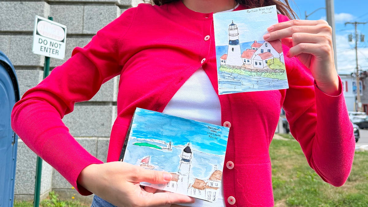
The trip commenced in Portland, where the author visited the Portland Head Light. Despite expecting cooler temperatures, she encountered 82-degree weather and significant mosquito activity. The itinerary included a stop at Ope! The Stationery, where she observed craft tables dedicated to community art workshops, and participation in Portland’s “First Friday” Art Walk. During this event, local artists sold prints on the sidewalk, and the Portland Museum of Art offered free admission.
Transitioning to Mt. Desert Island, the author relied on the map she had created at home. She describes the region as an "extremely touristic area" where maps are readily available to visitors, yet she found her own hand-drawn version sufficient for driving local roads. The group hiked the Dorr Mountain and Ladder trails, pausing for meals at the Salt Market and exploring Bar Harbor, which the author compared to her visits to Monterey, California.

Tidal Logistics and the Practicality of Travel
A central logistical challenge mentioned by the author is the timing of the land bridge to Bar Island, which is only accessible during low tide. She notes that visitors who miscalculate the tide—which turned at 11:30 a.m. during her visit—face a nine-hour wait for the next low tide or the alternative of paying $150 for a water taxi. This detail shows that local tourism relies on natural, shifting conditions rather than static schedules.
The author also emphasizes the role of the National Park in facilitating visitor engagement. At the Thunder Hole outpost in Acadia National Park, she utilized spare paper provided by the park for stamping her zine, an alternative to the official passport books often used by travelers to commemorate their visits.
Learning to Shuck at Glidden Point
The final segment of the trip involved a stop at the Glidden Point Oyster Farm on the Damariscotta River. The author recounts that, despite a history of consuming oysters in restaurant settings, the farm required visitors to shuck their own, providing a brief instructional lesson on the process. This experience served as the concluding lesson of the trip, with the author noting that she returned to New York having gained this specific skill.
The journal project itself served as both a guide and a record, with the author using the final pages to document new knowledge and preserve the stamps and sketches collected throughout the trip. By integrating the creation of a zine with the physical act of travel, the account demonstrates how personal documentation can alter the experience of a standard tourist route.