Severe Thunderstorm and Flash Flood Warnings Issued Across Massachusetts and Rhode Island
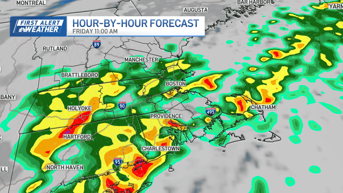
Heavy rain swept across southern New England, prompting a flash flood warning for parts of southeastern Massachusetts alongside a severe thunderstorm warning covering the same region, Cape Cod, and Rhode Island, according to NBC Boston. While those specific short-term warnings have since expired, a broader flood watch remains in effect for southeastern Massachusetts through Saturday morning. The unsettled weather pattern is bringing widespread rainfall totals of 1 to 3 inches across the region, with localized amounts of 4 to 5 inches possible where the heaviest rain bands stall.
The heaviest downpours are concentrating south of Boston, hitting the South Shore, Cape, and Islands hardest as rain persists through the day and into Friday night. Street flooding in poor-drainage areas poses the primary concern, while streams and creeks steadily rise and low-lying spots collect water. Fallen leaves clogging storm drains across local municipalities are compounding the drainage issues, leading to standing water on roadways throughout southeastern parts of the state.
Weekend Weather Progression and Transition to Drier Conditions
The initial round of rain is projected to taper off early Saturday morning, giving way to a cloudy morning and early afternoon. Another round of showers will move in during the Saturday afternoon and evening hours, bringing the potential for brief heavy downpours and small hail in some areas. Temperatures are remaining unusually mild for early November as these systems move through.
Conditions are expected to improve by Sunday, with most of the day turning dry once the sun comes up, though a few lingering morning showers remain possible north of the Massachusetts Turnpike. Temperatures will gradually cool off through the weekend, reaching highs in the upper 50s by Sunday. A cooler and mainly dry weather pattern is set to settle across the region by next week.