Coastal communities across seven regions in Lampung face potential coastal flooding as a perigean spring tide approaches.
The Badan Meteorologi, Klimatologi, dan Geofisika issued a warning regarding high sea levels expected between November 22 and 24, 2026. The agency points to the upcoming supermoon on November 24 as the primary driver for the elevated tides, which could inundate low-lying shorelines and disrupt local maritime activities.
Lampung Pesisir Districts Under Coastal Flood Warnings
The early warning covers seven coastal districts and cities across the province according to the agency’s regional advisory. The designated areas include Bandar Lampung, Lampung Selatan, Lampung Timur, Pesawaran, Pesisir Barat, Tanggamus, and Tulang Bawang.
Forecasters note that the impact will vary depending on local beach topography, settlement elevations, and existing seawall conditions. In Bandar Lampung, specific areas such as Bumi Waras, Panjang, Telukbetung Selatan, Telukbetung Timur, and Telukbetung Utara require close monitoring along the waterfront.
Meanwhile, Tanggamus encompasses multiple subdistricts on alert, including Cukuh Balak, Kelumbayan, Kota Agung, Kota Agung Barat, Kota Agung Timur, Limau, Pematang Sawa, Semaka, and Wonosobo, while Tulang Bawang focuses attention on the Dente Teladas coastal zone.
In Lampung Timur, the zones mentioned in the advisory include Braja Selebah, Labuhan Maringgai, Labuhan Ratu, and Pasir Sakti. In the Pesawaran region, the areas listed are Marga Punduh, Padang Cermin, Punduh Pidada, and Teluk Pandan. The Pesisir Barat area includes Karya Penggawa, Krui Selatan, Lemong, Pesisir Tengah, Pesisir Utara, Pulau Pisang, and Way Krui.
Ilham Agung Prayogo, a forecaster at the BMKG Maritime Meteorology Station in Panjang, said that high tides could affect port operations, including cargo loading and unloading work. Residents in coastal settlements, fishermen, and port workers are advised to secure items vulnerable to water damage, monitor environmental conditions, and adjust working schedules as needed.
Orbital Mechanics and Peak Timing of the Supermoon
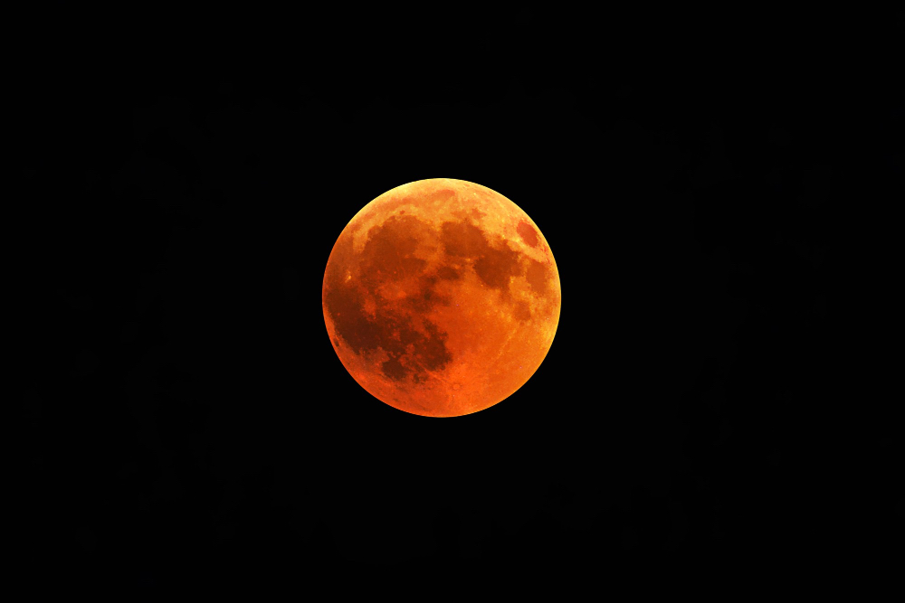
The astronomical alignment occurs because the Moon travels in an elliptical orbit rather than a perfect circle, changing its distance from Earth continuously. When a full moon coincides with this close orbital approach, known as perigee, it produces higher-than-average tides.
“The Moon’s elliptical orbit around the Earth means the distance between the Moon and the Earth is constantly changing,” said Teguh Rahayu, Director of Engineering Seismology, Potential Geophysics, and Time Signals at the BMKG, as published in the official agency report.
Ayu, who also serves as the Head of the Time Work Unit at the agency, said that the perigee phase indicates the Moon is heading toward its closest approach to Earth for the year.

The November 24 supermoon will feature an apparent radius of 16 minutes and 33.33 seconds of arc at a distance of 360,768 kilometers from Earth, ahead of the precise perigee peak on November 26 at 03:57 WIB with a distance of 359,346 kilometers, when the Moon will no longer appear as a complete circle.
NASA explains that during perigee compared to apogee, the Moon can appear up to 14 percent larger and 30 percent brighter, though these differences are subtle to the unaided human eye without direct comparison.
Badan Meteorologi, Klimatologi, dan Geofisika traces its origins to 1841, when Dr. Onnen, head of the hospital in Bogor, began individual observations. The Dutch East Indies government formalized it as the Magnetic and Meteorological Observatory in 1866, and the agency adopted its current name on 6 September 2008.
Since 1986, it has operated a Tropical Cyclone Warning Center in Jakarta, which the World Meteorological Organization temporarily transferred to Perth in 1998 before returning responsibility for the 2007–08 season. The agency now maintains 181 meteorological, climatological, and geophysical stations managed through five regional institutes.
The peak of the full moon on November 24, 2026, is scheduled for 21:53 WIB, or 22:53 WITA, and 23:53 WIT. Moonrise timings vary by location, with Jakarta at 17:36 WIB, Surabaya at 17:13 WIB, Kediri at 17:18 WIB, Makassar at 17:41 WITA, and Jayapura at 17:07 WIT.